Mill Road
- Beth Hoff

- Oct 23, 2022
- 3 min read
Updated: Dec 1, 2022

Mill Road once connected the south end of the Longmeadow Green to the grist mill and the sawmill on Shaker Road. While an 1822 deed in the Longmeadow Historical Society archives is the first reference that we have to the name “Mill Road”, the mills themselves were in business by at least 1809.
Longmeadow was an agricultural community and a grist mill provided an important service to our farmers. Grist mills ground grain between two millstones, converting bulky grain into more portable flour or meal. Farmers could then easily sell the flour or meal. Two millstones in the Storrs House Museum garden likely came from a Longmeadow grist mil.

Sawmills, likewise, served a necessary function in the community, creating boards and planks from logs to help build structures in a growing town.
The saw and grist mills and the general path of Mill Road appear on the 1831 map of Longmeadow. The machinery used what we would today consider a “green technology” – it was powered by water from Longmeadow Brook. Other grist and sawmills, which were powered by the Pecousic Brook at the north end of Longmeadow, also served the residents of Longmeadow and East Longmeadow.

1831 Map of Longmeadow
The mills changed owners several times in the 1800s. In 1850, Newton Colton ran the mills. That year, the grist mill produced 22,000 bushels of meal. The sawmill was equally productive, converting 3,700 logs to 35,000 feet of lumber.

1850 Industrial and Manufacturers Census Schedule
Sometime before 1855, a pond was created in Longmeadow Brook at the site of the mills.

1855 Map of Longmeadow
By 1880, Hamilton Reuben (or Reuben Hamilton) operated the grist mill. The Longmeadow Brook grist mill operated full-time for six months of the year and part-time for three months of the year. A water wheel with an eighteen-foot fall powered the grinding stones and the mill could produce 100 bushels of grain meal or animal feed per day.

1880 Flouring and Grist Mills Schedule
By 1891, Charles S. Allen owned the mills on Longmeadow Brook. The 1894 map shows that the sawmill had been replaced by a knitting mill. Mr. Allen also owned the Old Country Store at 776 Longmeadow Street, the building currently occupied by The Spa on the Green.

1894 Map of Longmeadow
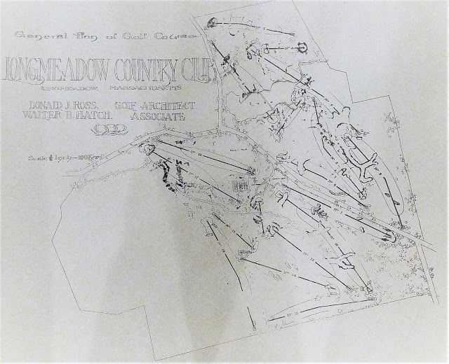
As the character of Longmeadow transitioned from a farming community to a suburban community in the early 1900s, Longmeadow residents no longer needed a grist mill and the mills were torn down. In the 1920s, the pond of Longmeadow Brook was incorporated into the Longmeadow County Club golf course; it is now known as Country Club Pond and is labeled on the 1922 plan below as “Lake”.

“General Plan of Golf Course”- Donald J. Ross and Walter B. Hatch
Today, you can drive on Mill Road only from Longmeadow Street to Brookside Drive. While the path from Brookside Drive to Shaker Road still exists, it is no longer paved or maintained by the town.

The intersection of Brookside Drive and Mill Road
Sources: 1831 Map of Longmeadow, 1855 Map of Longmeadow, 1894 Map of Longmeadow 1850 Industrial and Manufacturers Census Schedules 1880 Flouring and Grist Mills Schedule 1891 Valuation Report Longmeadow Historical Society Archives “General Plan of Golf Course,” Donald J. Ross and Walter B. Hatch, 1922 (Longmeadow Country Club Archives)
Contributed by Elizabeth Hoff, Longmeadow Historical Society Board Member
Originally published July 16, 2020


Comments